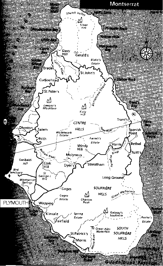
To the south of the straight line drawn across the map are the at-risk zones, comprising Hazard Zones A-D together with zone E(West). To the north of the line are the zones regarded as safe: E(East), F, G.
The volcano is in the Soufriere Hills. Galway's Wall lies above Galway's Soufriere; the threatened village of St Patrick's is on the SW coast. Tar River is to the south of Long Ground in the SE, between Long Ground and Ghaut Mefraimie.
The map was taken from Caribbean Islands Handbook, ed. Sarah Cameron (Footprint Handbooks / Passport Books, 1996). (Line delimiting hazard zones added by me, JCW. 1996 Dec 09)
